


Long before the days of satellites and GPS, the mapping of Ireland was painstakingly carried out by surveyors and engineers who travelled the country triangulating, levelling and plotting every corner of the land.
The Ordnance Survey Office was created in 1824 for the purpose of mapping the whole country. The original survey at a scale of 6 inches to 1 mile was completed in 1846 and made Ireland the first country in the world to be mapped at such a detailed scale.
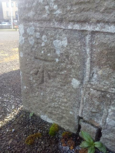
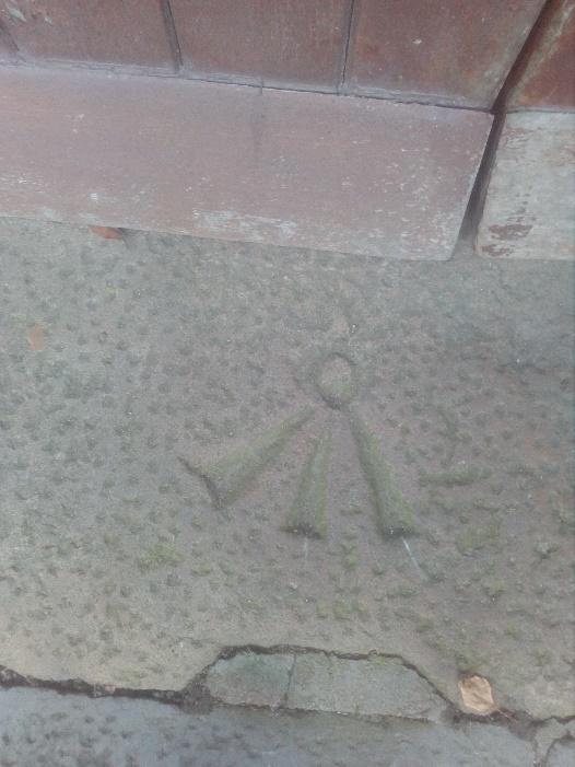
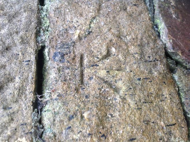
The levelling was done using a series of benchmarks which were carved into buildings, walls, bridges and other structures all over the country. The height of a benchmark was compared to the height of other nearby benchmarks all of which were ultimately measured from a datum point fixed at Poolbeg Lighthouse in Dublin Bay.
The benchmarks, sometimes called ‘sapper’s marks’ or ‘crow’s feet’, were created for the original 1846 and later surveys and were of such importance that they were once protected structures. Modern technology however has made them redundant and many have now been lost – destroyed through demolition or rebuilding work or simply buried under hedgerows. But others survive and can still be seen on walls and buildings all over the country. Indeed, many people walk past them every day completely unaware of their existence or significance.
The location of the benchmarks can be found on the 1888 – 1913 25-inch map. They are marked as BM with the height in feet beside the ‘crow’s foot’ symbol. Over 70 benchmarks were located in the twenty-four townlands of Killaloe. Most have disappeared for the reasons stated above but the following is a sample of some of those that still exist in plain sight around the Killaloe area:


It is very likely that more of these benchmarks are still around the area. Anyone interested in hunting for crow’s feet can find their locations on the 1888-1913 25-inch map at:
It would be great to find and document as many of these slivers of local history as possible before they are lost for good.

Example of Benchmark locations on the 25 inch map with height in feet and ‘crow’s foot’ symbol:
This article was researched and prepared by Darren O’Conaill
